
Cithaeron (or Kithairon) is a pine-forested mountain spread over 16 kilometers between Patera, Parnitha, and Gerania mountains.
It’s like nature’s divider, separating Boeotia to the north and Attica (Athens) to the south.
Mostly made of limestone and topping out at 1,409 meters, Cithaeron is perfect for a hike with amazing views of the Corinthian Bay and a dash of history.

Why would you hike in Mount Cithaeron? These are some of the reasons:
- The mountain features several hiking routes for all levels and two refuges (see more info at the end of the post).
- It offers stunning panoramic views of the mountains of Central Greece, northern Peloponnese, and the coastline of the Corinthian Gulf.
- If you love history, you can also explore the nearby archaeological sites and historical cities such as Plataea, Eleutherai, Aigosthena, and Thebes.
- Athens is just 55 kilometers away via a toll-free route, offering an ideal combination of mountain and sea for an easy outing in both winter and summer.
This post includes links that may be affiliate links. If you choose to purchase them, I may earn a small commission at no extra cost to you. Please see my disclaimer/privacy policy for more information.
Post Information & YouTube Video
This is a post about a circular hike on Mount Cithaeron starting and finishing from the Monastery of Agia Triada near the villages of Vilia and Plataea. Here is a short video of our day on the mountain:
At the foothills of Cithairon lies Plataea, an ancient town famous for the dramatic and final battle between the Greeks and Persians in 479 BCE, when the Greeks attacked and destroyed the Persian army.
Other ancient Boeotian cities on the slopes and foothills of the historical mountain included Erythrae, Scolus, Leuctra, and Eleutherai, which we visited on our way to Cithaeron.
Technical Information for the Cithaeron Hike

- Trail: Loop 12 km.
- Elevation: From 650 m to 1360 m
- Total Time: About 6 hours, including several breaks
- Level of Difficulty: Moderate, mainly due to the steep slopes and the rocky stones at times
- Terrain: Mostly dirt trail with the occasional large stones. The part of the trail toward the peak is shaded by a spruce tree forest. There are also many low bushes with thorns that scratch you.

- Signposts: Not so many, but there are red spots on barks or rocks or small signs with the 022 signposts. The path we hiked is part of the National Trail 02,2 which connects Athens with Parnassus mountain and crosses part of Cithaeron.
- Best time to hike: Preferably Spring to Fall. You should be cautious of wet weather when the paths will be slippery. We hiked in October.

- Participation Requirements: Good physical condition is required due to the steep parts and the duration of the trail.
- Gear: Ηiking poles will be useful, especially for the steeper parts. Avoid hiking shorts as you often have to walk off-path, among trees and bushes. Do not forget your hat and sunscreen if you hike in fair weather.
- Water: No water is available on the trail we followed, so stock up on at least 2 liters of water.
Ancient Eleutherai – First Stop

On our way to Mount Cithaeron, we stopped for a short visit to the Castle of Elftherai or Gyftokastro, one of the best-preserved ancient Greek castles.
The prevailing view today about the fortress is that it was a purely military camp built circa 370-350 BCE by the Thebans.

Within the fortress, the foundation of a temple from the 4th century BCE attributed to Dionysus Eleuthereus is preserved.
Gradually, the area declined and was abandoned. The traveler Pausanias, who passed through here around 145 CE, noted that the fortress was deserted.

Later, during the early Byzantine period, the fortress was used again. The last construction phase involved repairs to the southern wall and the remodeling of the gates (5th – 7th century CE).

Although this was a brief visit, I loved the ruins; they seemed both powerful and beautiful. The view of the valley was also quite impressive, leaving me with a sense of awe and a desire to explore more the next time I pass by!
Hiking Mount Cithaeron | Trail Breakdown
Our starting point was at the Monastery of the Holy Trinity (Agia Triada) built at 580 meters and 4 kilometers west of Plataea, in an area with particularly lush vegetation and beautiful scenery. It is a Byzantine nunnery built in the 15th century.
We were lucky because there was coffee and cookies for everyone when we arrived. There is also a spring where you can fill your bottle with fresh water because this is the last civilization point. Immediately starts the uphill towards the wind turbines and the ridge line of Cithearon.
The Ascent

The initial stretch of the trail was a steady uphill climb, winding through a landscape dotted with bushes and rocky outcrops.
Thankfully, we all wore long trousers as some of the bushes had thorns and the terrain was covered in loose stones that required careful steps.

At times, the path became difficult to follow, but occasional signposts guided our way. As we ascended, the vegetation thickened, and we found ourselves surrounded by a mixed forest of pine and spruce.

The trail took us to the west side of Cithaeron, offering amazing views of the mountain’s slopes and the valley town below.

However, the path was tough to follow, with tricky terrain, fallen trees, and few markers, making it a real adventure. This is where I tripped and scratched my ankle, thankfully nothing too serious, but it made my life a bit more difficult on the uphill.
Forest and Views

As we wandered along the trail, we reached the first trees of a beautiful pine and spruce forest. I felt quite relieved as it was getting hotter and hotter as the day progressed.

There were now more often signposts (added by the Hiking Group of Eleusis), either in the form of a tin sign on a tree or red paint on rocks, guiding us.

Climbing higher, the trees started to thin out, and I caught glimpses of the landscape beyond. Every step offered a new angle, revealing the stunning view of the Plataea Valley below.

The next part was a very steep uphill climb, which was especially difficult for me with my hurt ankle, but I somehow managed!
The incline led us to a wide local road that cars use to reach the peak and which we crossed for …more uphill!
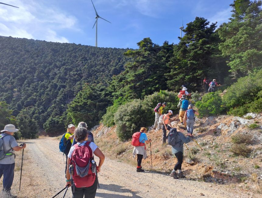
The trail wound its way through a dense forest and grew steeper and more challenging as we progressed.

The path became narrower, and navigating the increasingly rocky terrain required a firm grip on our walking sticks.

At several points, we had to scramble over large stones and boulders, making the hike both physically demanding and exhilarating.

At some point, we stopped for at least 20 minutes to rest and have something to eat; it was a really needed break.

Soon we were climbing again, but we were almost there on the ridge line. All around us, the view was simply stunning. We crossed another dirt road and reached a large bend in the wind turbine road.
This recently constructed road has damaged parts of the old path; however, two large sections remain intact, which we follow until we reach the lower summit.

The change from the dense woods to the open, windy peak with the wind turbines making their menacing noises was incredible.

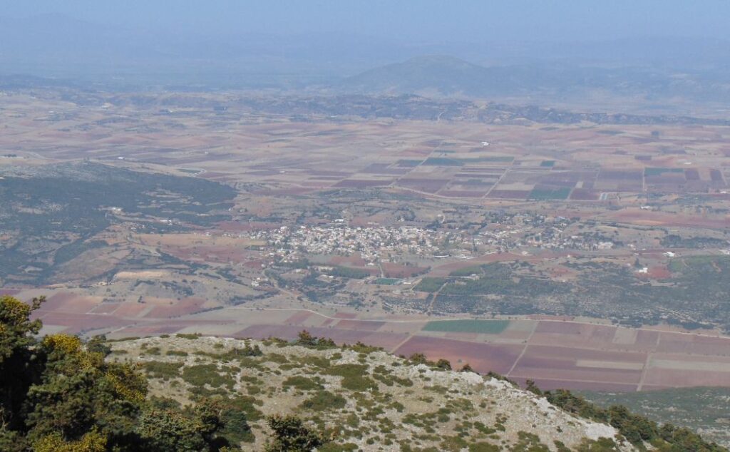
From the top, the view was nothing short of spectacular. We could see for miles in every direction, the Plataea Valley spread out beneath us like a living map.
The sweeping panorama included distant mountain ranges, rolling hills, the Corinthian Gulf, the northern coasts of the Peloponnese, and the mountains Ziria, Chelmos, and a little further west, Panachaiko.
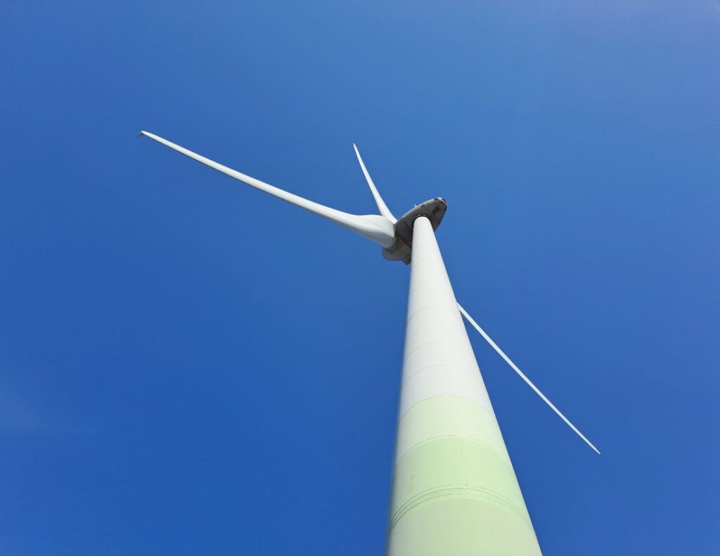
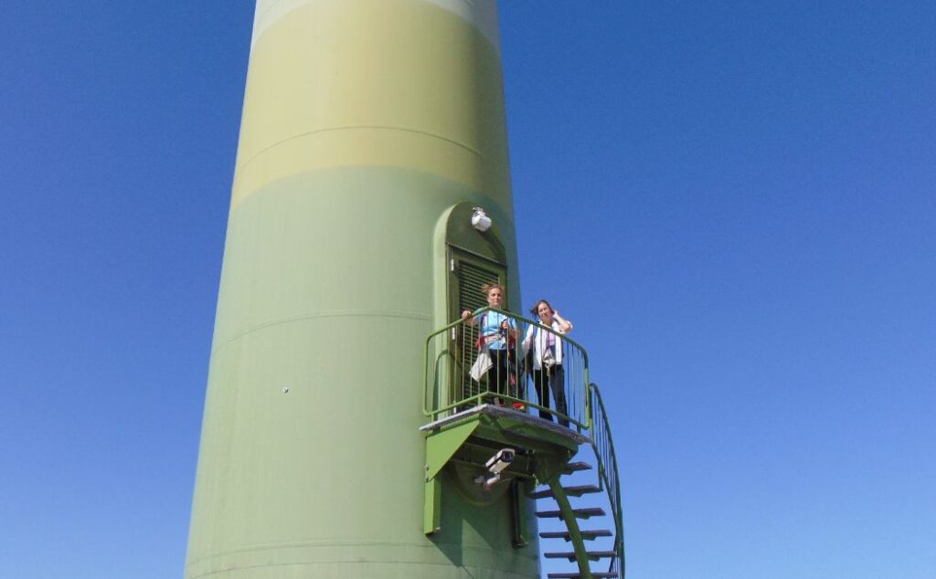
To the north, the mountains of Boeotia with their wind turbines, Parnassus and Helicon, the Theban plain, and its villages faded into the southern haze. To the east, the land of Attica-Boeotia. A beautiful spectacle!
Some time later we descended from the same trail to our coach bus that took us to Vilia for a well-deserved lunch and coffee! As always, after a beautiful hike, a sense of completion and satisfaction overwhelmed me.
Greek Mythology and Cithaeron
There is a strong connection between Mount Cithaeron and Orpheus, a legendary musician and poet with a tragic love story.
He first introduced and performed the mysteries of Dionysus in this area, so the mountain often echoed with the sound of his lyre (Cithara in ancient Greek), and thus it was named Cithaeron.
On Cithaeron, Oedipus of Thebes was abandoned as an infant, where a shepherd found him and delivered him to Merope, the wife of King Polybus of Corinth.

Another myth concerning the mountain is the story of the Lion of Cithaeron.
The lion lived on the mountain and terrorized the inhabitants of the area. Hercules eventually managed to kill it and began wearing its skin long before he killed the lion of Nemea!
Attractions Near Cithaeron
There are quite a few things you can do around Cithaeron. Here are my favorite ones:
Explore Vilia, a peaceful semi-mountainous town with charming houses, a lovely square with tavernas and cafes, and a tradition of dairy products and local meats.
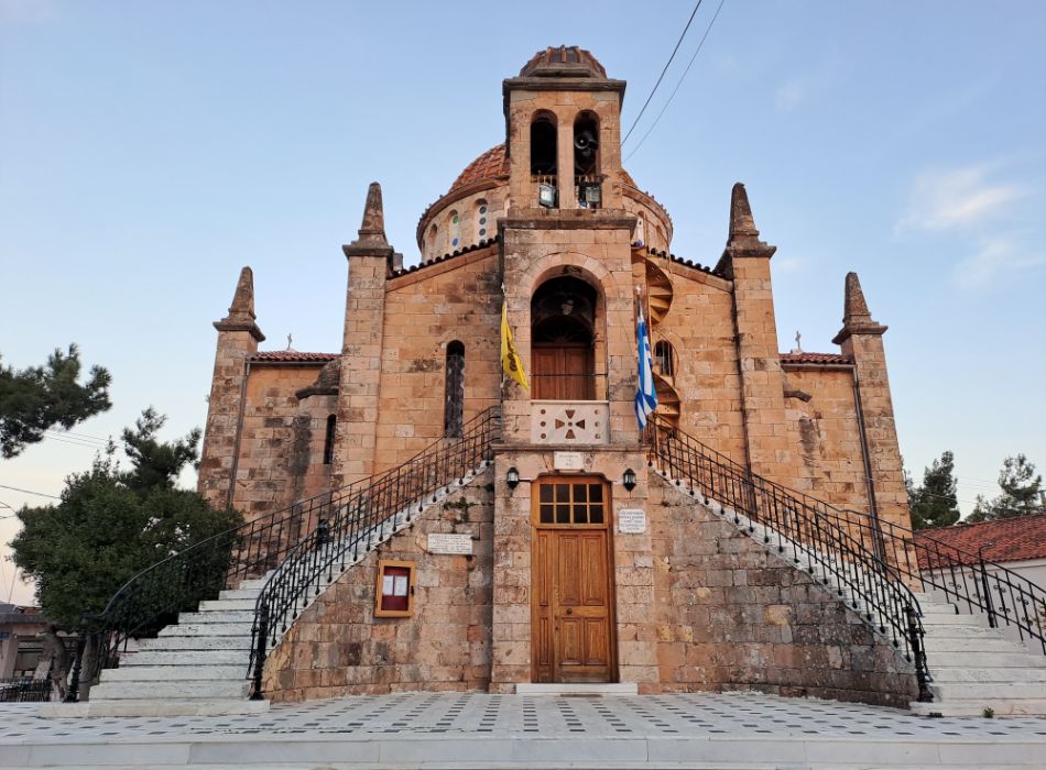
The town has some beautiful Byzantine churches to visit, including the Church of the Transfiguration (1893) made by the famous architect Theodor Ziller, the Archangels Church (1637), and Saint Athanasios (12th century).
The main attractions of Cithaeron from the Attica side are the impressive Fortress of Aigosthena, the seafront town of Porto Germeno and the Holy Monastery of Hosios Meletios at an altitude of 600 meters, and various picturesque chapels from the pre-Byzantine and Byzantine periods.
Where is the best place to stay for Hiking Cithaeron
It makes sense to stay in Vilia, an authentic Greek mountainous village, if you would like to enjoy the lively atmosphere there.
A central hotel with beautiful views of the town, large rooms, and a generous breakfast is Idillion Hotel (budget, family-friendly).
Alternatively, you can stay at the two Cithaeron Refuges organized by the hiking association of Eleusis: the first at 1,090 meters inside the forest, accessible via the road from Vilia to the summit of Cithaeron, and the second near the summit.
How to Get to Cithaeron
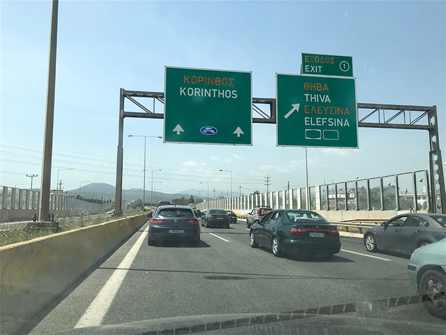
From the Athens-Corinth National Road towards Elefsina (Eleusis), take the exit for Mandra and Thebes (Thiva), just before the first tolls, and turn right onto the Old National Road towards Thiva.
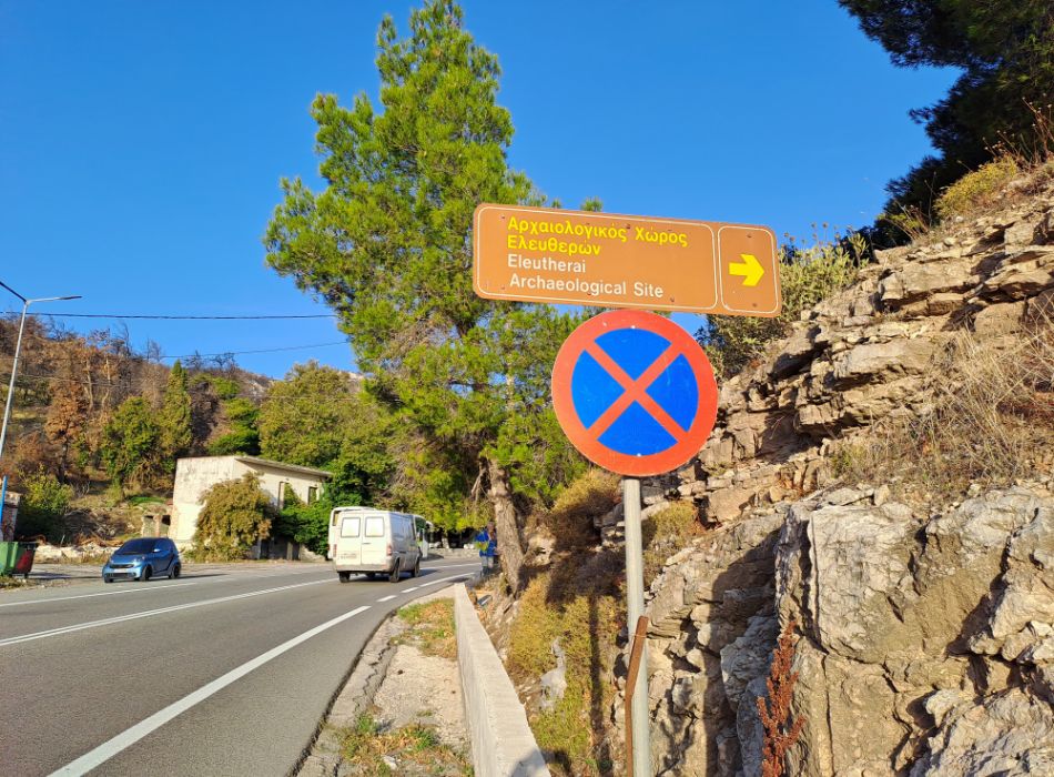
Pass through Mandra and continue on a semi-mountainous route, where you will also see the sign for Elreutherai for about 50 km until you reach Vilia (there is a sign).
Turn left towards Vilia and at the exit of the village, follow the signs towards Porto Germeno and Cithaeron. The trail begins just 1.5 km outside the village.

There is a very good bus infrastructure in Greece and trains that connect mostly northern Greece with Athens.
For me, the most convenient and adventurous way to explore mainland Greece and the islands is by rental car. I love the freedom of going wherever I want, whenever I want!
Popular Trails in Greece

Exploring Greece through its hiking trails is an absolute delight! From the rugged beauty of the northern Pindus range, Olympus, Vikos Gorge, and Meteora to the captivating Menalon Trail, Taygetus, and Vouraikos Gorge in the Peloponnese, there’s a diverse range of landscapes to discover.
And let’s not overlook the breathtaking island paths offering stunning vistas of the Aegean and Ionian Seas. It’s every hiker’s paradise!
What are you waiting for? Pack up and discover Greece through hiking!
Essential Greece Traveling Tips
- ‘Hello’ and ‘Thank You’ in Greek: “Ya sou” and “Efharisto”
- Emergency Numbers Anywhere in Greece: AMBULANCE 166 – FIRE 199 – POLICE 100– EMERGENCY NUMBER 112
- Athens Metro Website (timetables and ticket info)
- Map of Athens Metro
- Trains (Hellenic Train)
- Public Buses KTEL
- Booking.com: I use Booking.com because I can get the best deals on hotels and apartments, free cancellations, and great prices!
- FerryScanner to book ferries to the Greek Islands
- Rent an Affordable Car in Greece
- Get Your Guide: For all your day or multi-day tours and city guide needs, I use Get Your Guide
