
Agrafa is a mountainous region of exceptional beauty, encompassing many small villages in the Evrytania and Karditsa areas of Central Greece.
Agrafa Borlero, standing at 2,017 meters, is one of the highest peaks in the Agrafa mountain range.
The entire Agrafa region has been recognized by UNESCO as one of the five areas on Earth with the cleanest environment, owing to its rugged terrain and challenging accessibility.

Agrafa represents the southernmost part of the Pindus mountain range, which serves as the backbone of Greece.
The landscape has spruce trees, black pines, chestnuts, and oak trees, while the alpine zone is covered by meadows where thousands of sheep, goats, and cows used to graze during the summer.
Nowadays, fewer than a handful of shepherds are active in the area.

However, when visitors arrive, they’re met with lush forests, shady gorges, and rivers so clear you can see right through them, all coming together to make this place a real ecological paradise.
Due to the distinct and challenging nature of the region, the installation of wind-powered generators is prohibited on its saddles and peaks.
The foothills of the Agrafa mountain range mark the origin of the Tavropos and Agrafiotis rivers, known for their pristine waters that host trouts, carp, perches, and otters.
We spent three days in the area in mid-October, enjoying favorable weather conditions and conquering one peak each day. On the first day, we ascended to the Borlero peak (2,017 m), one of the most impressive peaks in Agrafa.
Other notable peaks in Agrafa include the highest, Karava or Schizokaravo (2,184 m), along with several others:
- Delidimi(2163m)
- Voutsikaki (2154m)
- Moutsara (2120m)
- Svoni or Paramithias (2040m)
- Fteri (2128m)
- Flitzani (2017m)
- Plaka (2005m)
- Pente Pirgi (Five Towers) (2010m)
This post includes links that may be affiliate links. If you choose to purchase them, I may earn a small commission at no extra cost to you. Please see my disclaimer/privacy policy for more information.
Post Information for Agrafa Borlero

In this post, you will find information on a hike starting at Elatos village and ending at Kedros (or Zygoyanneïka) village after reaching the Agrafa Borlero peak.
The road distance between Elatos and Kedros is 11 km, taking approximately 35 minutes by car to cover.
Technical information for the Agrafa Borlero peak hike
- Trail: 10,5 km, one way.
- Elevation: From 1.140 m to 2.017 m. Elevation gain: 945 m, Elevation loss: 990 m.
- Total Time: About 7.00 hours, including breaks.
- Level of Difficulty: Moderate.
- Terrain: Mostly earth path in the forest part, grass in the alpine zone, and rockier close to the top. The first leg is rather steep, and the descent is steep at the beginning but becomes less steep after the middle of the trail.
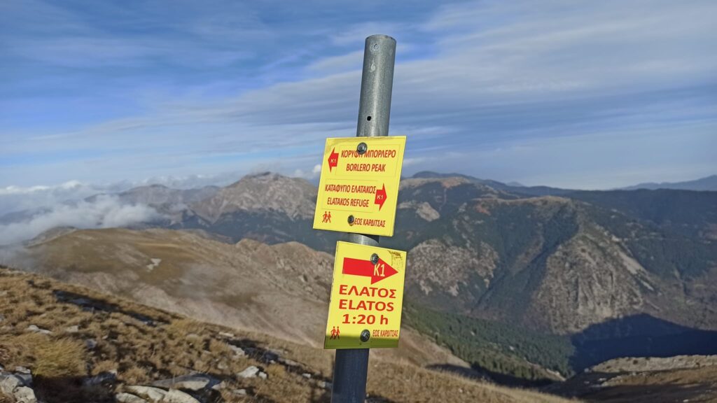
- Signposts: The trail is marked by the EOS Karditsas and is designated as K1. The marking (yellow with a red lozenge in the middle) safely guides you even in difficult weather conditions.
- Best time to hike: All year round. In winter, the conditions are much more difficult because of the low temperature and the cold wind. There is also a possibility of snow, especially between January and March. The beech trees and oak trees offer a nice range of yellow to red colors from late October to November.
- Participation Requirements: Not demanding under good weather conditions. However, a good physical condition is required due to the 1.000 m altitude difference and the steep slope near the top.
- Gear: Ηiking poles will be useful near the top. A fleece jacket may be needed as the last part may be windy. In winter, you will need warmer clothing and rainproof gear.
- Water: You will find a water source on the trail at 3,2 km from the end, so take enough water with you.
Hiking the Agrafa Borlero Peak Trail

Elatos, a small settlement at 1.200 meters, was the starting point of our hike, 18 km and a 40-minute car drive from where we had camped (Anthiro Itamou).
There is an earth road just opposite the church of Saint Kosmas Aetolos that continues in an eastward direction. (Google Earth coordinates: 39⁰ 14’ 25” N, 21⁰ 41’ 14” E).

At the beginning of the earth road, you will see the following sign indicating the direction to Borlero peak as well as the altitude, the distance of 3,2 km (our path was 3,5 km long), and the estimated time to the top (2 hours).
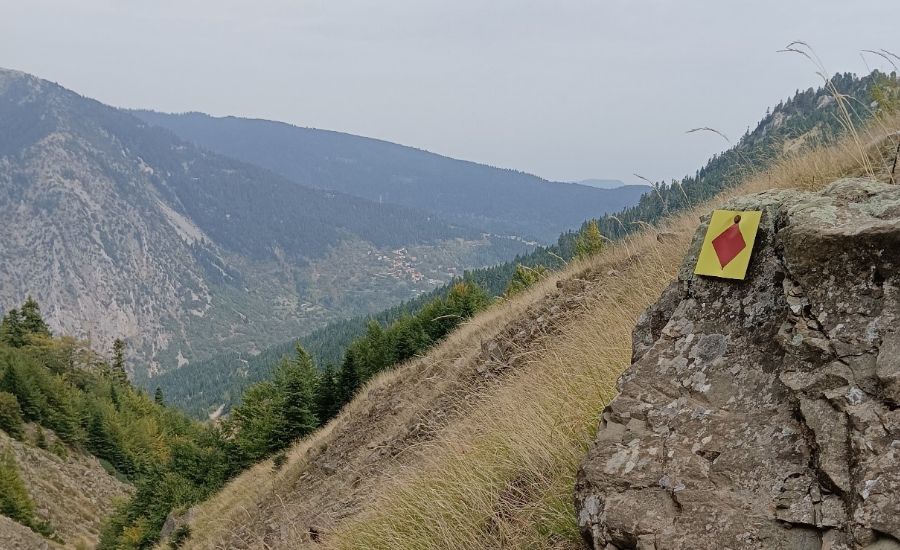
The sign also indicates the type of marks to follow: red lozenges with a yellow frame and the label K1.
The earth road is quite short as it just leads to some shepherds’ houses nearby. If you find that the signaling is not very dense, you can follow the path registration on the Wikiloc app. (Agrafa1 – Borlero peak, find the link at the end of the post).
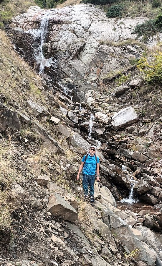
After 1,5 km, you will need some caution to cross a narrow stream. There wasn’t much water when we crossed it but there might be more in the springtime.
After crossing the stream, head towards the ridge that leads to the Borlero peak.
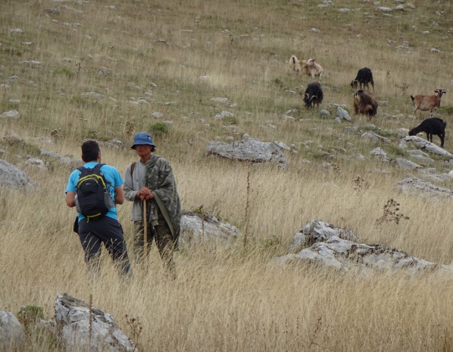
At approximately 1.700 m of altitude, you will reach the alpine zone. In this area, we met one of the very few shepherds still active in this mountain range, with his herd of goats.
From this point, you do not yet see Borlero peak as it is hidden by other smaller peaks. But when you reach it, you will be compensated by a great 360⁰ view, assuming a clear sky will allow it.
The eastern part of Borlero (Elatakos area) has been incorporated into the Natura 2000 network of protected areas.
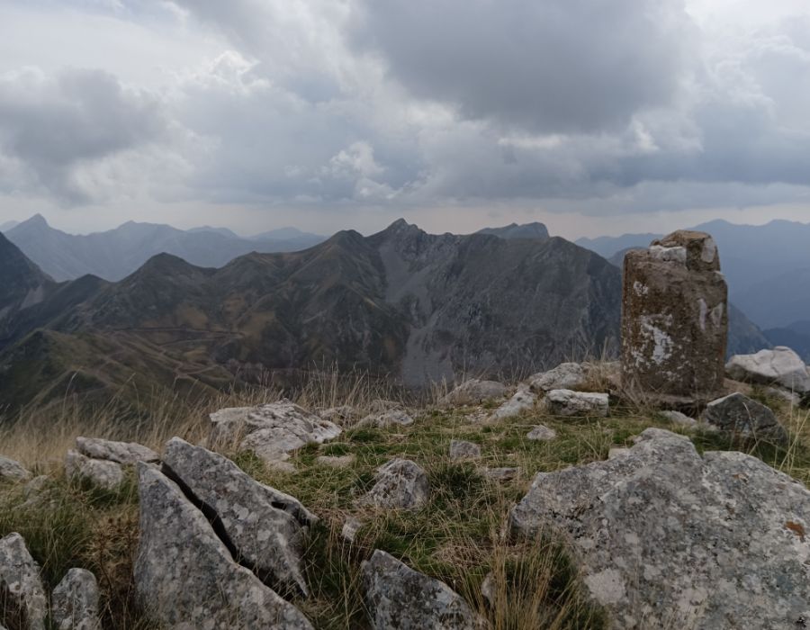
To the south, you may see, among others, the peaks we reached on the following two days of our expedition: Five Towers and Svoni.
Leaving the Borlero peak, we followed a different path more eastwards. Three hundred meters after crossing an earth road, at 700 m from the top, you will enter the forest area, and 500 m further up, you will pass through the Agrafa Gate.

This is considered to be the border between two parts of the Agrafa mountain range: the part belonging to the Administrative Region of Sterea Ellada and the part belonging to the Administrative Region of Thessaly.
Past the Agrafa Gate, you will follow a downhill path and you will also have a nice view of the Plastira artificial lake.

1,7 km past the Agrafa Gate, you will reach the Perdikovrysi spring.

At that point, you shall turn right, following this sign indicating the direction to the Elatakos refuge.
You will hike the beautiful fir forest of Belokomiti, and after 45 minutes and 1,7 kilometers of hiking, you will reach the refuge located at the site ‘Elatakos,’ at an altitude of 1.456 meters.

This is a very nice and simple non-catered, fenced refuge offering some beds, tables in the yard, electric lights supplied by a photovoltaic installation, etc.
It is a single-room wooden building of 17 square meters with 6 beds (accommodating a total of 12 people), constructed in 1996 by the Developmental Corporation of Karditsa.
The refuge is open to anyone but if you use it, you should take care to leave it at least as clean and tidy as you found it.

Following the path and one more indication, you will reach, after 2,4 km, the Kedros (Zygoyanneïka) village, which is the end of the trail.
From Kedros, we drove to Anthiro village (11.5 km in 38 minutes) where we camped and stayed overnight.


Here is the Wikiloc record named “Agrafa 1 – Borlero peak”.
Where to Stay in Agrafa
Luxurious guesthouses do not exist in Agrafa; there are just a few rooms with the basics. Since fewer people are raising livestock these days, the population has really dropped over the past few decades.
Kyra Niki is a homely guesthouse in the remote Agrafa village, the best accommodation option in the region.
If you would like a more luxurious stay, you should go to Pandion Luxury Boutique Hotel & Suites with Spa in Plastiras Lake in the most developed village, Neochori.

One may also try to camp in villages. Outside the summer months, the arrival of tourists is a welcome event for the few locals. We camped at the central square of Anthiro village. One has to pay attention to the cow dung, but otherwise, the location was fine.
There was a fountain and two cafes/restaurants. Mr. Yannis, the owner of one of them, is very friendly with hikers.
Needless to say, the prices in the mountain villages are among the lowest one can find in Greece (coffee 1€, beer 2€, main course 5€, salad 2,5 €).
How to Get to Agrafa
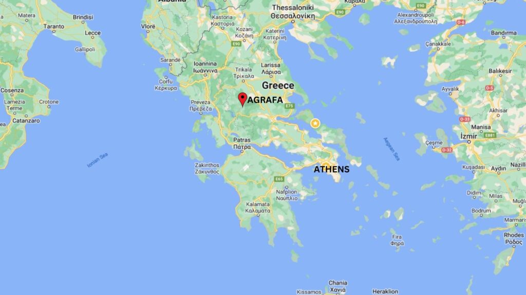
The best way to reach Agrafa from Athens is by rental car through the Lamia-Karpenissi National Road. The distance is 325 km, and the estimated cost for tolls and gasoline is 110 euros for a round trip.
From Thessaloniki, calculate 300 km and a cost of 120 euros for a round trip. Although the main dirt road is accessible by a regular car, it is advisable to have a 4X4 vehicle with good tires, especially during winter.
Tips for Visiting Agrafa

- Plan: Book your room in advance and confirm that someone will be there waiting for you. Public transport is rare and doesn’t go everywhere. Rent a car to be independent and move around the region more easily.
- Bring Plenty of Water and Snacks: Hiking in the Agrafa region may involve varying elevations and temperatures, so it’s crucial to stay hydrated. Carry an ample supply of water and pack energy-boosting snacks like trail mix, granola bars, and fruits to keep your energy levels up.
- Respect Nature and Wildlife: Agrafa is known for its rich biodiversity. Respect the local flora and fauna by staying on designated trails, avoiding littering, and refraining from disturbing wildlife. Take only photographs and leave no trace of your visit.
- Inform Someone About Your Plans: Before setting out on a hike, inform a friend or family member about your plans, including your chosen trail, expected return time, and any emergency contacts. This precaution ensures that someone is aware of your whereabouts in case of unforeseen circumstances.
- Respect Local Culture: Agrafa has a rich cultural heritage, and you may encounter local communities during your hike. Be respectful of their customs and traditions. If you plan to visit any villages along the way, consider learning g a few basic Greek phrases and be courteous to the locals.
What does Agrafa mean?
Agrafa, in Greek, translates to ‘nonwritten’ or ‘non-registered.’ Legend has it that the region earned this name because neither the Byzantine nor the Ottoman empires could effectively collect taxes in this rugged area.
Consequently, it was omitted from their fiscal registers. Additionally, there is a mountain village named Agrafa, situated at an altitude of 840 meters in the heart of the Agrafa mountain range.
Popular Hiking Destinations in Greece

Thanks to the country’s versatile and mountainous terrain, hiking in Greece offers a diverse and captivating experience. From the rugged mountains of the Pindus range and Vikos Gorge to the north to the Menalon Trail in the Peloponnese to the coastal trails overlooking the Aegean and Ionian Seas, Greece presents a hiker’s paradise.
The country boasts well-maintained paths that wind through ancient olive groves, dense forests, churches, monasteries, ancient ruins, rivers, and charming villages, providing hikers with a unique blend of natural beauty and cultural richness.
Did you hike to Agrafa Borlero Peak? Let me know what you think about Agrafa in the comments. I’d love to hear whether I managed to get it onto your bucket list!
