
Paiko is a small mountain range located northwest of Thessaloniki, approximately 20 km in a straight line from the border with North Macedonia.
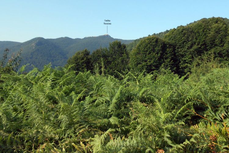
Its most famous peak is Gola Tsouka.
The nearest town is Goumenissa, known for its large monastery, grape fields, and wineries.

Paiko is a beautiful mountain, characterized by numerous water sources, streams, and gently sloping terrain covered with deciduous trees.
We spent three days in the area in early January, enjoying favorable weather conditions as we explored a different trail each day.
On the first day, we ascended to the Gola Tsouka peak at 1,650 m. (Gola Tsouka means ‘naked peak’ in Slavic) since there is no vegetation in its proximity.
This post includes links that may be affiliate links. If you choose to purchase them, I may earn a small commission at no extra cost to you. Please see my disclaimer/privacy policy for more information.
Post Information
In this post, you will find information on a hike to the Paiko Gola Tsouka peak.
Although we stayed in Goumenissa town, the trailhead is located at ‘Paliochori,’ just after the wooden structure of the Goumenissa Forest Authority, approximately 16 km from the town (a half-hour drive by car).
Mountain Paiko Terrain

Paiko hosts the largest chestnut tree forest in Greece, along with many beech trees, plane trees, and 2.500 other plant species along its rivers and streams that flow throughout the year.
This results in distinctly different landscapes between summer and winter, featuring beautiful fall colors.
As for its fauna, the most common animals in the area are wild boars, wolves, jackals, badgers, foxes, weasels, hedgehogs, bats, hares, and squirrels. and 57 different species of butterflies.

Additional notable peaks in the region, apart from Paiko Gola Tsouka, include Kadasi (1,607 m), Pyrgos (1,494 m), Vertopia (1,490 m), Tsuma (1,219 m), and Skra (1,097 m).
The area in Mountain Paiko is ideal for hiking, climbing, and mountain biking. Additionally, every November, the ‘Paiko half-Marathon’ takes place on a well-marked trail.
Technical information for the Paiko to Gola Tsouka
- Trail: 11.3 km. Out-and-back trail.
- Elevation: From 1.105 m to 1.644 m. Elevation gain/loss 565 m.
- Total Time: About 5.00 hours, including short breaks.
- Level of Difficulty: Moderate.
- Terrain: Earth path and earth road in the forest part, rockier and steeper close to the top.

- Signposts: Red paint on the trees and some wooden signs.
- Best time to hike: All year round. In winter, the conditions are more difficult because of the low temperature and the possible presence of snow that may hinder, in some cases, access to the top. The beech, chestnut, plane, and oak trees offer a nice range of yellow to red colors from late October to November. We hiked in early January 2024.
- Participation Requirements: Not demanding under good weather conditions. However, good physical condition is required due to the steep rocky slope near the top.
- Gear: Hiking boots and clothing corresponding to the weather conditions.
- Water: You will not find any water source on the trail. So, take enough water with you according to the season.
Paiko to Gola Tsouka Breakdown

The trailhead is located at a place called ‘Paliochori,’ marked by a right turn off the asphalt road just after passing the wooden structure of the Goumenissa Forest Authority.
You’ll notice an earth road leading under a metallic arcade on your left. Follow this earth road, and as you proceed, you’ll pass by a fenced area with another wooden house on your left.
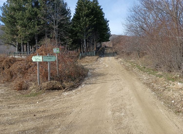
You will soon meet an intersection. Continue straight ahead, taking a shortcut to the left road.
Once you rediscover the main earth road, cross it and continue in the same direction, entering a path, thus taking a second shortcut.
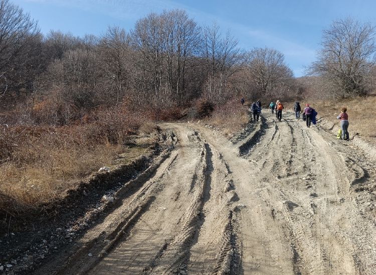
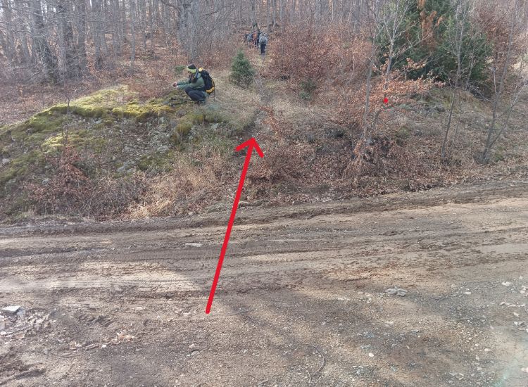
Shortly after, you will find the earth road once more. Turn left onto it, and after approximately 20 meters, following a right turn, locate the path on the left.
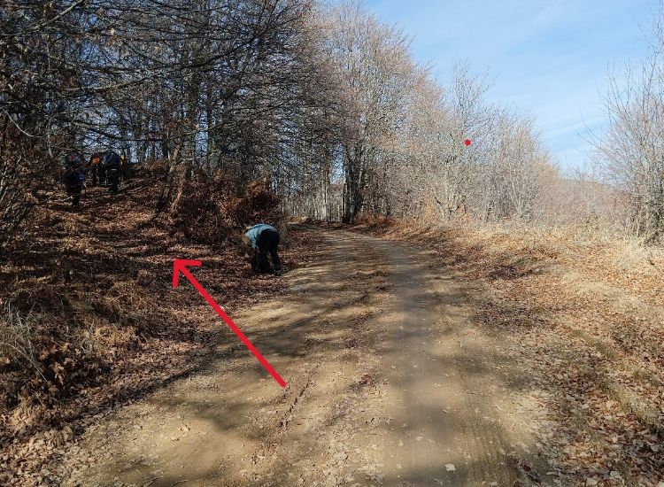
After a short distance, you will come across a broad path paved with stones, serving as another shortcut for the same earth road.

Even if the fallen tree is still there, it will be easy to overcome.
After meeting the earth road again, continue along it for another 1.3 km until you reach an intersection. Follow the earth road as it turns left, and on your left, watch for a red sign on a tree indicating the direction to Gola Tsouka (ΓΚΟΛΑ ΤΣΟΥΚΑ written in Greek).
After one more km, leave the earth road to take the path to the right indicated by one more red sign and confirmed by the additional red signs on the trees.


After another 1.5 kilometers, you’ll reach the base of the final slope that leads to the ascent towards the peak.
This marks the steepest section of the trail, but it is a brief one, spanning just about 200 meters.
Upon reaching the summit, you’ll be greeted with a magnificent panorama encompassing Thessaloniki and the Aegean Sea to the southeast, as well as the Vorras mountain.
Vorras, also known as Kajmakcalan—a name of Turkish origin used by Bulgarians and Serbs who fought against each other there in 1916 during WWI—is the third highest peak in Greece, situated on the border with North Macedonia.

To descend via a more gradual slope, we proceeded southeast off-trail. Upon reaching the first cluster of trees, we turned left, heading north, until we eventually located the path guiding us back to the base of the summit. We retraced our steps along the same route for the return journey.

Here is the Wikiloc record named “Goumenissa Day 1 – Paiko peak”
Related Article: Paiko Day 2: Exploring Stravopotamos
Where to Stay in Paiko
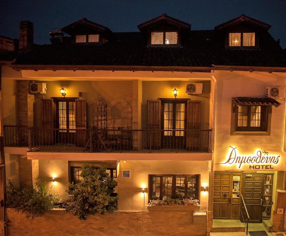
We stayed in Goumenissa, a picturesque town built on the foothills of the mountain. Goumenissa has 4,500 residents and is renowned for its good wine, clean waters, tsipouro, and traditional copper instruments, which are famous worldwide.
There are very few accommodation options in the area. We stayed at Dimosthenis Hotel (budget, family-friendly), which is a popular hotel. If it is fully booked, you can also try at Dallia Loft Space (mid-range, family-friendly) in Goumenissa. At nearby Polykastro village, there are two nice hotels: Park Hotel Polykastro (budget, family-friendly) and Hotel Astro (budget, family-friendly).
How to Get to Mountain Paik,o Greece

You will need a rental car if you are traveling to Paiko from Athens. Taking the national road towards Thessaloniki (504 km) would be best.
After the toll booths, 20 km before Thessaloniki, at the height of Chalkidona, you will turn left towards the Evzones customs. At the Kilkis junction, if you turn left, you will pass through Polykastro, Axioupoli, and reach Goumenissa.
From here, the ascent to the main villages of Mount Paiko begins. As an indication, consider the following distances: Goumenissa – Kastaneri 12 km (asphalt) and Goumenissa – Megala Livadia 26 km (asphalt).
You will need to cover just 65 kilometers from Thessaloniki to reach Goumenissa. Gas stations can only be found in Goumenissa, where tire repair shops and car service stations are also in operation.
What to Do and Visit in Paiko Mountain
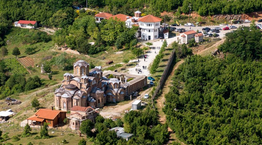
In Goumenissa and throughout the villages nestled on the slopes of Paiko, you can find at least five wineries that showcase the local indigenous Xinomavro variety. Additionally, there are old monasteries scattered across the region that are well worth a visit:
- The 13th-century historic Monastery of Panagia in Goumenissa.
- The Monastery of Saints Raphael, Nicholas, and Irene is just outside of Griva.
- The Yanpatzi Watermill (18th century) operated until the early 1970s. Today, fully restored, it is open to visitors on weekends. You can find it on the road from Goumenissa to Griva.
Popular Hiking Destinations in Greece
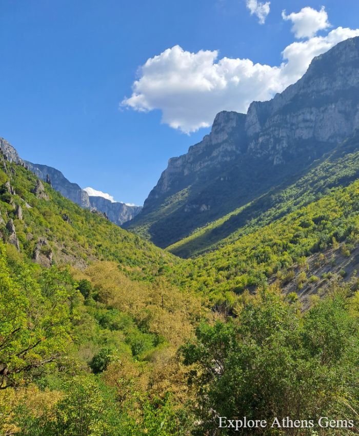
Hiking in Greece offers a diverse and captivating experience, thanks to the country’s versatile and mountainous terrain. From the rugged mountains of the Pindus range and Vikos Gorge to the north to the Menalon Trail in the Peloponnese to the coastal trails overlooking the Aegean and Ionian Seas, Greece presents a hiker’s paradise.
The country boasts well-maintained paths that wind through ancient olive groves, dense forests, churches, monasteries, ancient ruins, rivers, and charming villages, providing hikers with a unique blend of natural beauty and cultural richness. What are you waiting for? Pack up and discover Greece through hiking!
Did you hike to Paiko? Let me know what you think about the mountain in the comments. I’d love to hear whether I managed to get it onto your bucket list! Until next time, Joseph.
*Some of the links in this post are affiliate links. That means I may make a commission if you click and buy. The commission comes at no additional cost to you.
Essential Greece Traveling Tips
- ‘Hello’ and ‘Thank You’ in Greek: “Ya sou” and “Efharisto”
- Emergency Numbers Anywhere in Greece: AMBULANCE 166 – FIRE 199 – POLICE 100– EMERGENCY NUMBER 112
- Cheap Flights to Greece
- Athens Metro Website (timetables and ticket info)
- Map of Athens Metro
- Trains (Hellenic Train)
- Public Buses KTEL
- Booking.com: I use Booking.com because I can get the best deals on hotels and apartments, free cancellations, and great prices!
- FerryScanner to book ferries to the Greek Islands
- Rent an Affordable Car in Greece
- Get Your Guide: For all your day or multi-day tours and city guide needs, I use Get Your Guide
