
On our second day in Paiko Mountain, after our challenging first day of climbing Gola Tsouka Peak at 1,650 m, we hiked a beautiful, circular, and demanding trail, passing through the recreational area at Stravopotamos River in Paiko.
The Stravopotamos River originates from the source (five springs) located at the entrance of the Megala Livadia.
It is a gorgeous route that includes 9 wooden water bridges, is well signposted, and is called the Pramataris – Stravopotamos trail.
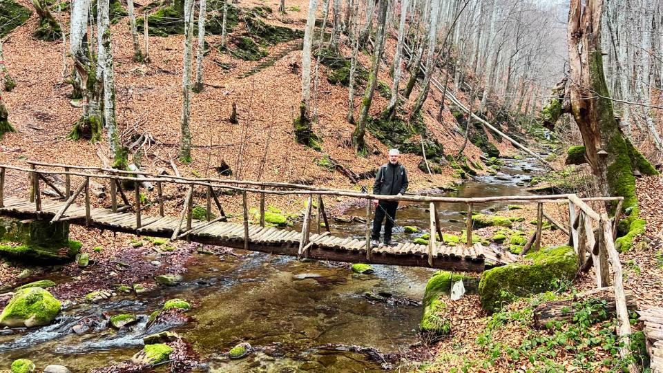
The trail is almost entirely inside the forest which means that in early January we walked over a carpet of brown leaves from the oak trees and beech trees. Really beautiful nature.
This post includes links that may be affiliate links. If you choose to purchase them, I may earn a small commission at no extra cost to you. Please see my disclaimer/privacy policy for more information.
At a Glance
The Pramataris – Stravopotamos in Paiko trail is a loop hike that starts near the wooden building where the Goumenissa Forest Authority’s Center for Environmental Awareness is located.
You’ll spot it right before a bend in the road, about 3.5 km past Kastaneri village. It’s approximately a 16 km drive from Goumenissa to the trailhead, taking around half an hour by car.
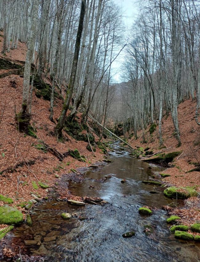
- Distance: 16,3 km.
- Elevation: From 730 m to 1.345 m
- Elevation gain/loss: 860 m
- Total Time: About 6.30 hours, including short breaks.
- Level of Difficulty: Moderate.
- Terrain: Mostly earth path with short parts on earth roads or in streambeds.

Best time to hike: All year round. In winter, the conditions in Stravopotamos, Paiko are more challenging due to the low temperatures and the potential presence of snow, which can obscure the path, requiring special attention on the descent.
The beech trees, chestnut trees, plane trees, and oak trees offer a nice range of yellow to red colors from late October to November. We hiked in early January.
Participation Requirements: Not demanding under good weather conditions. However, a good physical condition is required due to the steep descent and ensuing ascent in the first third of the trail.
Gear: Ηiking boots and clothing corresponding to the weather conditions.
Water: You will not find any water source on the trail. So, take enough water with you.
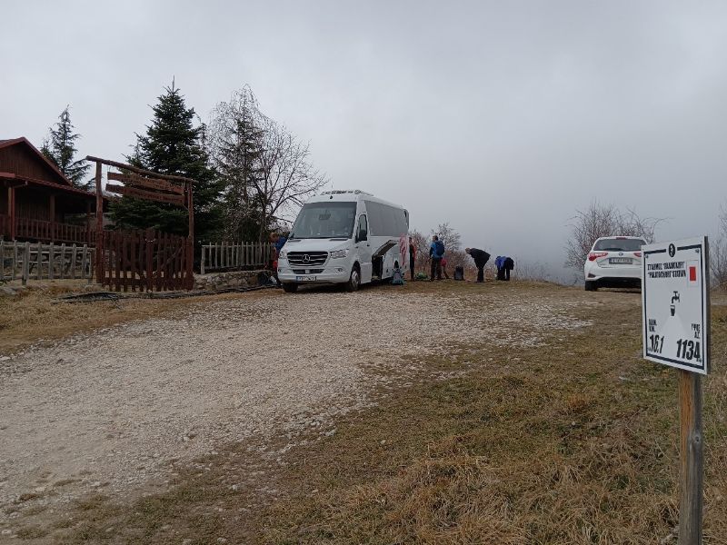
The trailhead, at the location called “Paliochori”, is at a right turn of the asphalt road just after the wooden structure of the Goumenissa Forest Authority Center.
You will start in front of the fence. Leaving it behind you, taking a SE direction, following an earth road which turns left after 100 m.
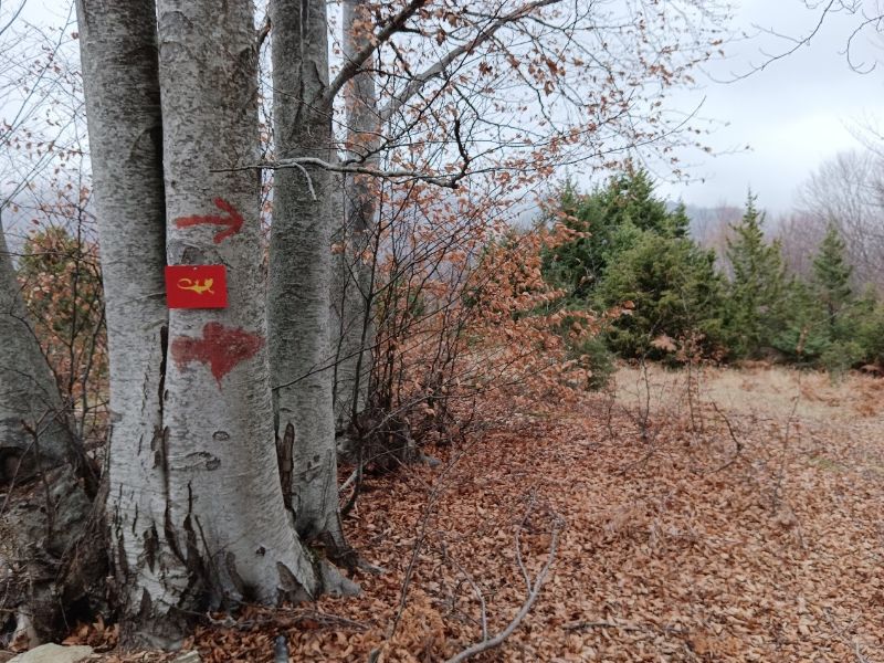
The trail is marked with three types of signs:

Red paint marks on tree trunks, yellow salamanders on a red background, and large white signs indicating the altitude and distance.
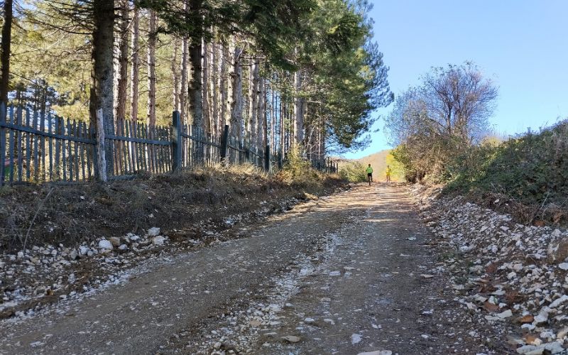
The last two types of markers and the info they provide mostly match our trail, but they’re not always spot-on because they’re meant for the Paiko semi-marathon that is held in the fall. The marathon is part of the International Trail Running Association (ITRA).
One perk of hiking this trail right after the race is that you’ll come across a nicely kept and cleared path.
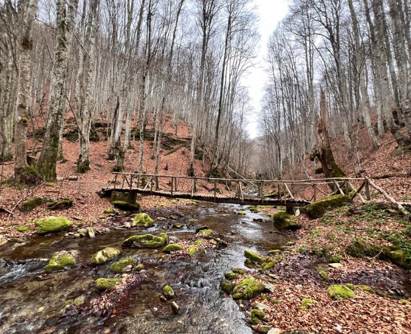
The path of Stravopotamos in Paiko is rather straightforward, going downwards (from the initial 1.130 m of altitude to its lowest point at 735 m) for about 2,9 km amidst the forest until it reaches the Stravorema water stream.
You will cross the same stream many times along the trail, using the nice wooden bridges, named after the Greek mythology muses.
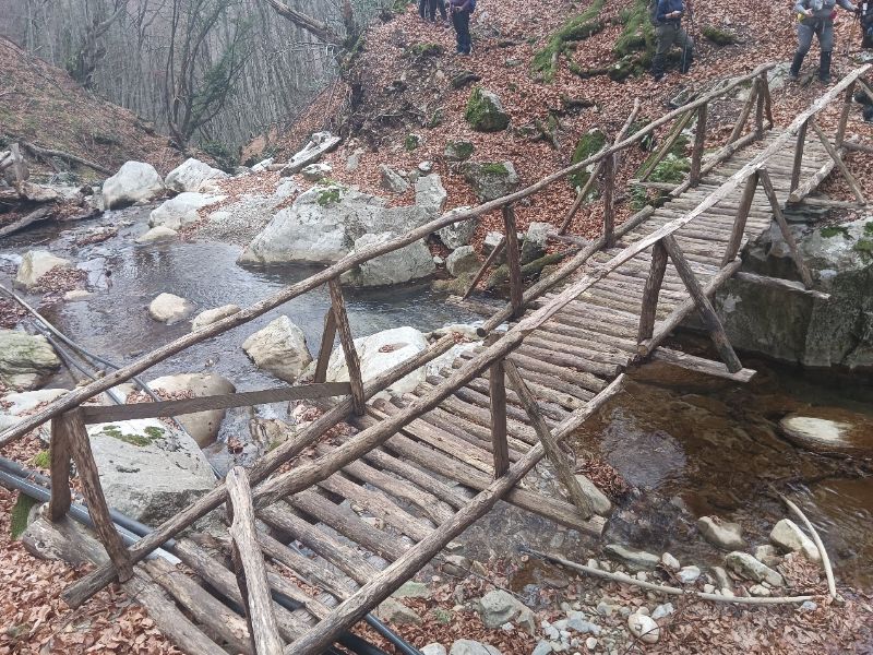
Past this first crossing, begins the most difficult part of the trail, where, in 700 m, you will have to gain 200 m of altitude.
At the end of this steep ascension, you will turn right on an earth road, and in 300 more meters, you will turn left to continue the ascension.
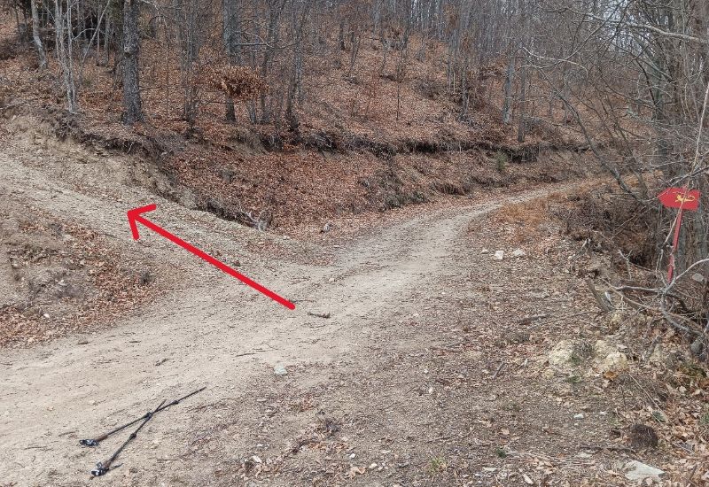
After 900 m you will turn right, following the relevant sign, and after 1.200 more meters, you will turn left on a larger earth road to follow for 2,3 easy km after which you will leave the earth road to enter a descending path to the left.
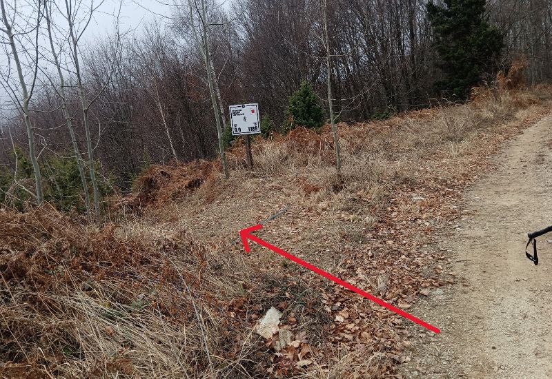
In about 1,1 km you will reach the Gorgopis River, one of the more beautiful spots of the trail.
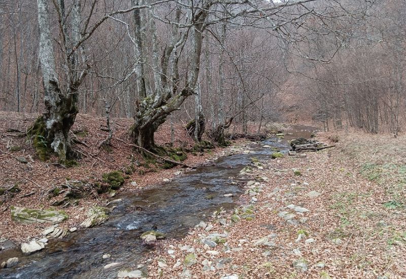
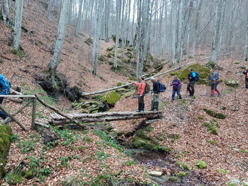
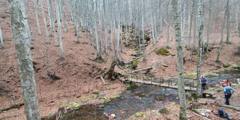
In 1,6 more km, you will reach a recreational area on the bank of the Stravorema water stream.

This area is accessible, from the other side, by an asphalt road therefore, you can end the hiking here, provided you make arrangements for road transportation to the trailhead.
On the trail, you’ll turn left onto the asphalt road. After about 100 meters, turn right onto a path that leads into a small valley.
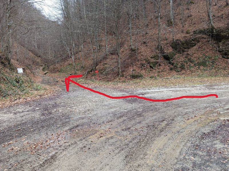
Here, the trail gets steeper for about 200 meters, and after another 500 m, you will turn right at the sign.
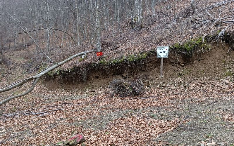
Brace yourself for a steady climb of about 1,2 kilometers (or 0.8 miles) that will take you to the highest point of the trail at 1,345 meters. 400 meters down from the peak, you’ll reach a junction with a dirt road. Continue straight ahead at this intersection.
To the right is the trail to the peak Gola Tsouka visited on our first day in Paiko Mountain. Straight ahead is the same part of the trail we followed on the previous day, in the opposite direction, to reach this point.
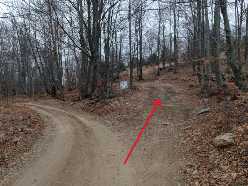
From this point onwards, you only need to follow the sign to the right, 1.400 m after the last intersection, and less than 1,5 km awa,y you will have returned to the trailhead.
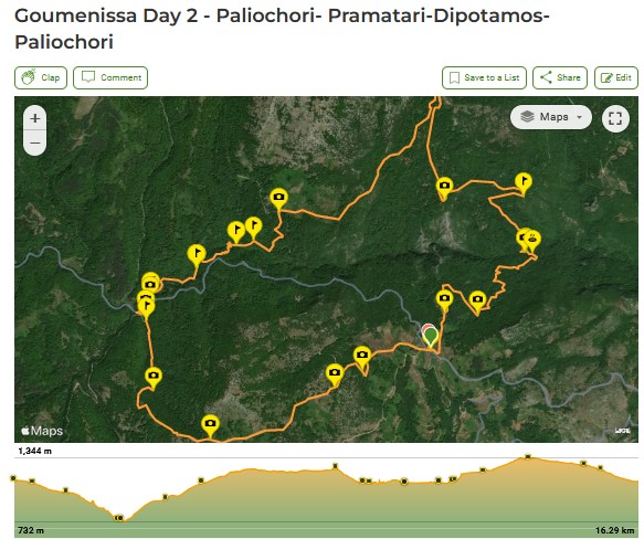
Here is the Wikiloc recording named “Goumenissa Day 2 – Paliochori- Pramatari-Dipotamos-Paliochori”.
Where to Stay in Paiko

Either before or after your Stravopotamos in Paiko excursion, take some time to explore the charming trailhead village of Goumenissa. With a population of 4,500, Goumenissa is celebrated for its excellent wine, pristine waters, tsipouro, and traditional copper instruments.
Some of the sites you can explore are:
- The 13th-century historic Monastery of Panagia in Goumenissa.
- The Monastery of Hosios Nicodemus the Athonite is in Pentalofos.
- The Yanpatzi Watermill (18th century) operated until the early 1970s. Today, fully restored, it is open to visitors on weekends. You can find it on the road from Goumenissa to Griva.
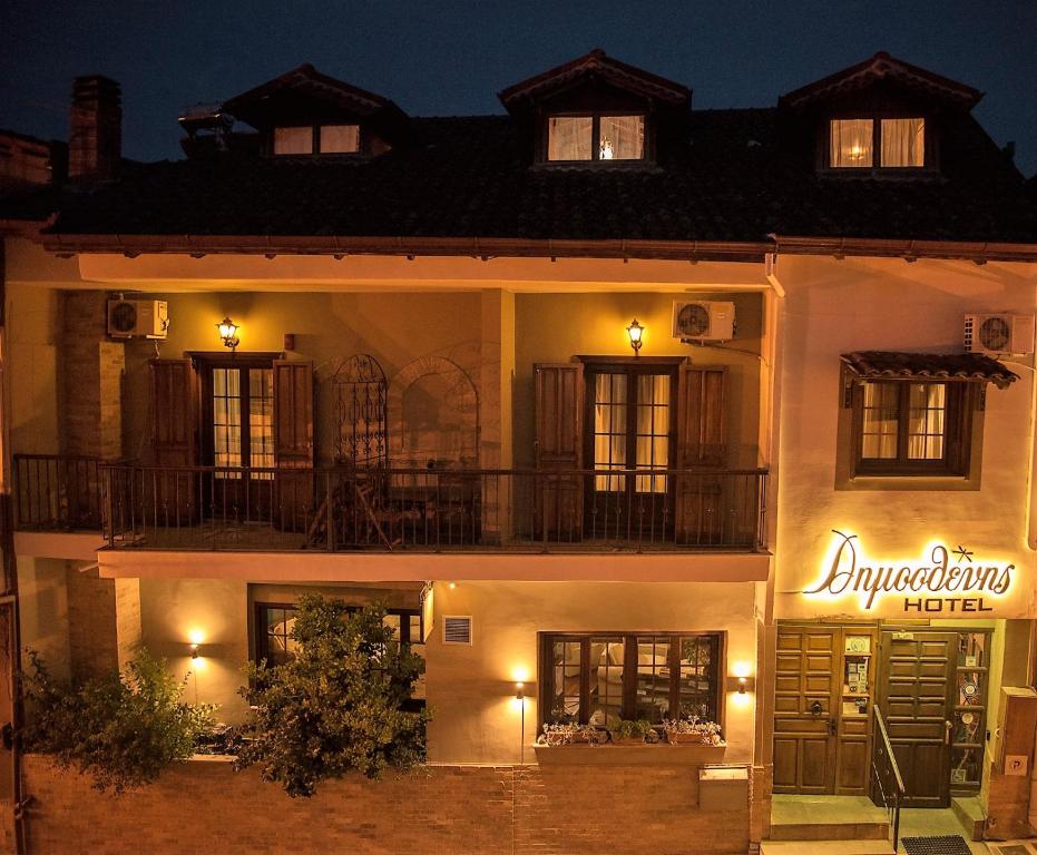
There are very few accommodation options in the area. We stayed at Dimosthenis Hotel (budget, family-friendly), which is a popular hotel.
If it is fully booked, you can also try at Dallia Loft Space (mid-range, family-friendly) in Goumenissa. At nearby Polykastro village, there are two nice hotels: Park Hotel Polykastro (budget, family-friendly) and Hotel Astro (budget, family-friendly).
How to Get to Mountain Paiko, Greece from Athens

If you are traveling to Paiko from Athens, you will need a rental car. It would be best to take the national road towards Thessaloniki (504 km).
After the toll booths, 20 km before Thessaloniki, at the height of Chalkidona, you will turn left towards the Evzones customs. At the Kilkis junction, if you turn left, you will pass through Polykastro, Axioupoli, and reach Goumenissa.
Related Posts:
Essential Greece Traveling Tips
- ‘Hello’ and ‘Thank You’ in Greek: “Ya sou” and “Efharisto”
- Emergency Numbers Anywhere in Greece: AMBULANCE 166 – FIRE 199 – POLICE 100– EMERGENCY NUMBER 112
- Cheap Flights to Greece
- Athens Metro Website (timetables and ticket info)
- Map of Athens Metro
- Trains (Hellenic Train)
- Public Buses KTEL
- Booking.com: I use Booking.com because I can get the best deals on hotels and apartments, free cancellations, and great prices!
- FerryScanner to book ferries to the Greek Islands
- Rent an Affordable Car in Greece
- Get Your Guide: For all your day or multi-day tours and city guide needs, I use Get Your Guide
